Comparing Radar and Lidar in ADAS: Technologies Shaping the Future of Driving

What is the Difference Between Radar and Lidar?
Radar and Lidar: Signal Type
Radar penetrates fog and clouds using radio waves between 30 cm and 3 mm in wavelength to locate distant objects. It calculates distance and velocity while bouncing radio waves off objects and returning to the radar antenna using time-of-flight. Yet, its angular resolution is restricted to around one degree. Thus, it’s difficult to differentiate closely spaced objects. Radar technology, including MIMO antenna arrays, has improved its resolution and imaging. Remember, MIMO (multi-input multi-output) radar systems might include 128–2,000 channels for resolution. It can produce point-cloud images like lidar but for long-range and speed detection.
In contrast, lidar uses micrometer-wavelength laser beams (903 and 905 nm for specific systems) to build high-resolution, three-dimensional maps of its surroundings. It enables precise object recognition, including form and size, with a few centimeters resolution at 100 meters. lidar’s shorter wavelength and higher frequency provide dense point clouds for 3D modeling in autonomous vehicle navigation and environmental scanning. Although lidar offers more precision and resolution than radar systems, heavy rain or fog may impede its effectiveness, and its higher cost has prevented its widespread deployment.
Radar and Lidar: Principle of Operation
Radar uses the Doppler effect and time-of-flight measurements to estimate distance, speed, and direction via radio wave transmission and reflection. Radar systems measure target reflections’ time delay and frequency shift with radio waves. Newer radars, including Synthetic Aperture Radar, can identify things over long distances using high-resolution imaging that can discriminate between surfaces and objects in storms or through barriers.
Lidar uses laser beams to map and measure distances. These systems build 3D point clouds of the surroundings while emitting thousands to millions of laser pulses per second and measuring their bounce times. It allows centimeter-level distance measurements in high-resolution maps, 3D city modeling, and vehicle autonomous navigation systems. GPS data and Inertial Measurement Units may improve spatial accuracy and mapping detail.
Applications of Radar and Lidar
Radar Applications
Radar technology is essential for the long-range detection and tracking of high-speed objects in military and civil aircraft. For example, air traffic control systems use radar to monitor and regulate aircraft movements in large airspace sectors, which can detect things around 60 nautical miles away. Phased array radar systems can detect many ballistic targets at thousands of kilometers in missile defense. It shows the radar’s critical security capabilities.
Radar is vital to car safety because of obstacle detection and blind-spot monitoring. Contemporary automobiles use 24 GHz and 77 GHz radar sensors to locate objects up to 250 meters distant in certain ADAS systems. Radar alerts drivers to probable crashes, supports emergency braking systems, and enables adaptive cruise control to change vehicle speed depending on traffic. Its ability to work in fog and rain adds to its importance in car safety.
Lidar Applications
Lidar technology, which has accurate range and high-resolution mapping, is essential for 3D environment modeling. Lidar sensors allow AVs to traverse complex urban landscapes since they give 360-degree environmental awareness. If governments allow them, we predict 8–17 million elegant AVs on the road by 2030. Meanwhile, lidar’s high-resolution point clouds, which may include millions of points per second, can recognize even stray dogs and potholes. It enables extensive and proactive decision-making in autonomous navigation.
In addition to autonomous cars, lidar transforms archeology and forestry management. Without ground surveys, lidar lets archaeologists see buried buildings and penetrate thick vegetation to learn about past civilizations. For example, lidar research in Guatemala has found over 60,000 buried Maya ruins. It offered unique vistas of pre-Columbian cultures. On the other hand, lidar helps analyze forest biomass and structure while measuring tree height, canopy density, and terrain differences. It is necessary for sustainable management, carbon stock calculation, and forest ecosystem monitoring, proving lidar’s applicability.
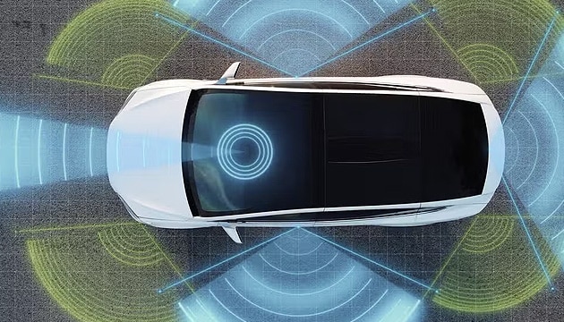
Lidar vs. Radar Autonomous Driving ADAS
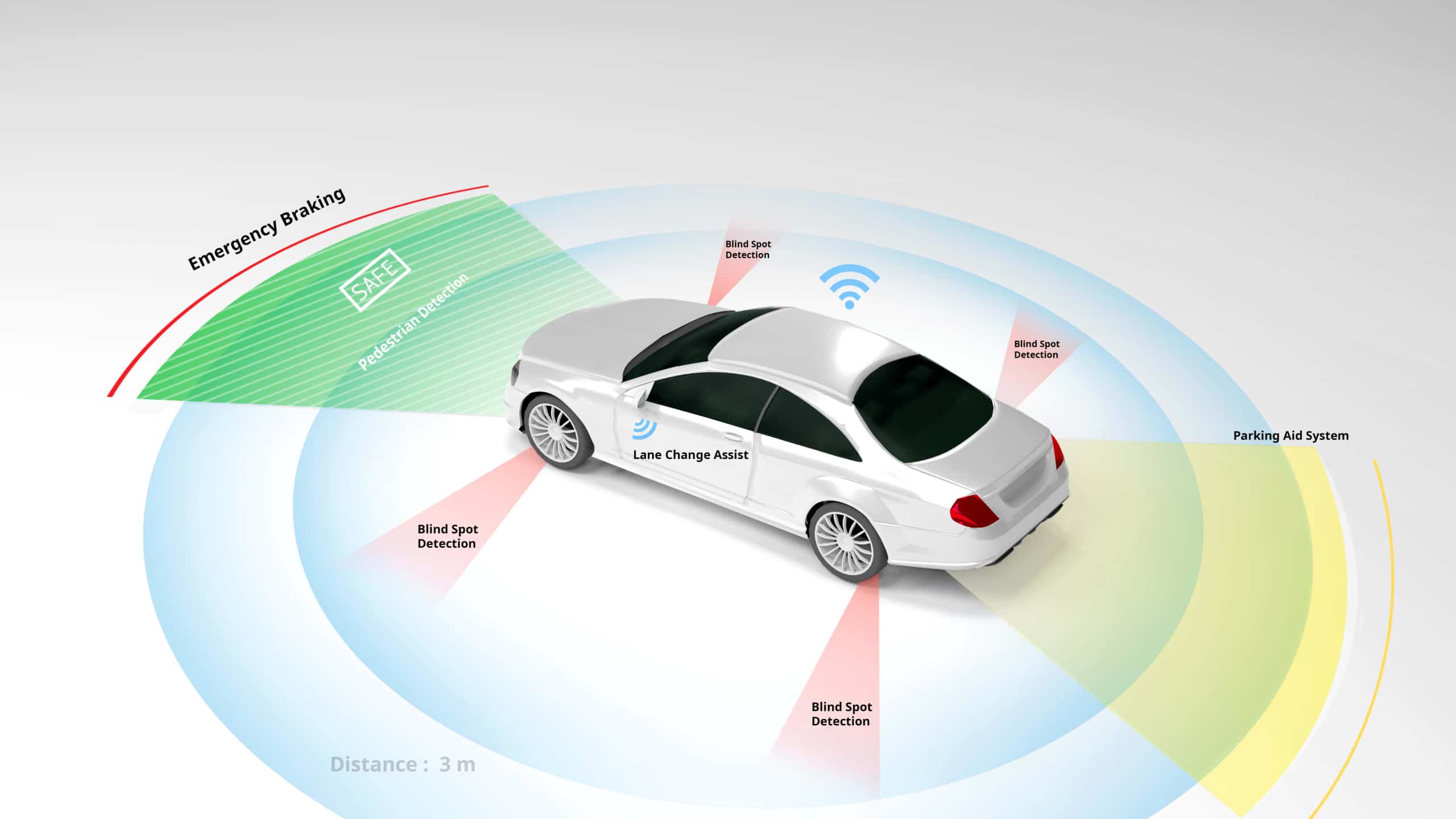
Combining radar and lidar in ADAS orchestrates a symphony of sensor-based inputs for vehicle security and economy. Radar uses electromagnetic waves to sense and evaluate long-range velocity across environments for adaptive cruise control and collision avoidance. However, lidar uses laser pulses for high-resolution, 3D maps of the vehicle’s surroundings. It enables exact item recognition and classification for lane-keeping and pedestrian detection. This lidar vs. radar autonomous driving symbiosis provides spatial and temporal awareness, combining radar’s weather resistance with lidar’s spatial accuracy.
Integrating these technologies with cameras, ultrasonic sensors, and algorithms gives ADAS a multi-layered perception net for decision-making. For instance, radar measures object velocity up to 250 meters away for emergency braking systems. Nevertheless, lidar adds exact object outlines for better performance in tricky circumstances. This joint strategy accentuates the lidar vs. radar autonomous driving question while showing that their coalescence strengthens ADAS. Autonomous cars with an integrated sensor plan might cut accident mortality by 90%. Consequently, it stresses the value of combining radar and lidar capabilities to traverse many hurdles in autonomous and semi-autonomous driving.
FIC’s Advanced ADAS Solutions
Through the integration of radar and lidar technologies into our AR HUD and ADAS systems, FIC improves automobile safety with cutting-edge technology. In the lidar vs. radar autonomous driving debate, our solution combines lidar’s 3D mapping and object identification accuracy with radar’s weather resistance. Henceforth, we create ADAS technologies that boost vehicle autonomy and protection. As we strengthen these technologies to satisfy the changing demands of future mobility, we invite enthusiasts and experts to investigate FIC’s contributions to car security and independence.


